
|
|
The goal is to engage and educate community members on local groundwater processes and sustainable development of water resources. The lessons learned over the five year period in Rocky View County (RVC) will be used to create a legacy for not only RVC, but additional municipalities in Alberta and elsewhere. The goal is also to create a methodology that encourages municipalities throughout Alberta to adopt a similar program - leading to a comprehensive groundwater data set.
|
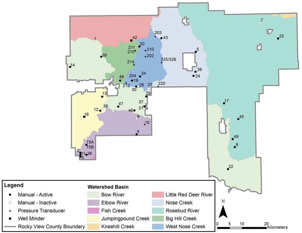
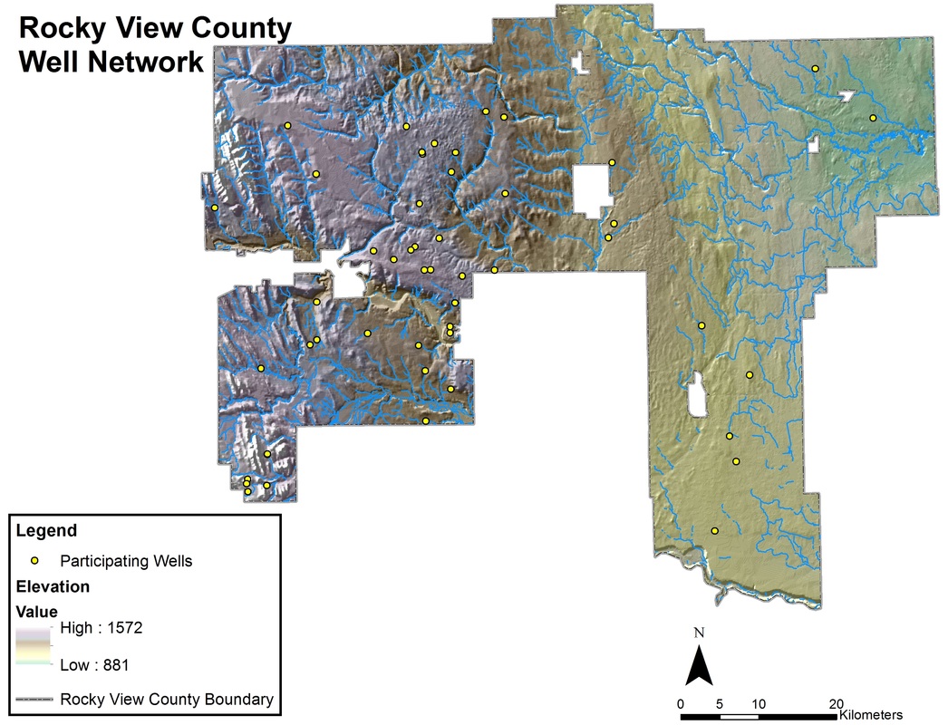
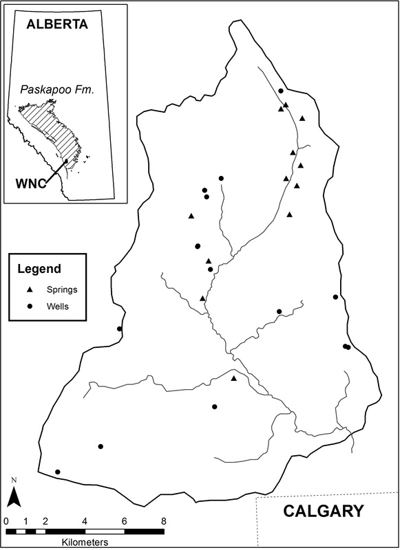
HistoryThe interest for the study came from a desire to learn more about the Paskapoo Formation, a regional aquifer system. When the predecessor to the current project was initiated in 2004 by a graduate student, Lisa Grieef and Dr. Masaki Hayashi, groundwater was gaining priority in Alberta, due to the demand in rural areas and drought conditions. They identified the need for scientific data, to assist in water resource management and policy development. The management and policy development of water in Alberta was also gaining recognition through the Water for Life Strategy created in 2003 by Alberta Environment. The strategy was created to ensure economic sustainability of water resources for present and future generations and emphasized the need for research and monitoring to acquire knowledge about Alberta’s water resources. Although long term monitoring of water resources can provide important data, it can be expensive, particularly for groundwater networks, as wells must be drilled into the aquifer. For this reason, the density of monitoring wells that can economically be monitored by the province is minimal. Therefore, the solution proposed by Ms. Grieef was to develop practical methodologies that could support sustainable water management (2007). The original watershed was selected due to a gauging station near the city limits of Calgary established by Alberta Environment, which could provide historical data on stream water levels. The lessons learned during this project were published in Ms. Grieef’s thesis and a journal paper, and provided the foundation to expand the project to the County. The Current Study The lessons learned from the original pilot project were used to expand the scope of the project beyond a single watershed (West Nose Creek) to the County. The project is focused on obtaining a comprehensive long-term data set on groundwater levels across the County (RVC). Landowners follow the same procedure of measuring water levels in their well twice a month and reporting the results to Rocky View County and/or the University of Calgary. This data is then analyzed and feedback is provided to the County and participating landowners through newsletters and open house events. In addition, a web portal was developed and launched in December 2011. This web portal allows landowners to directly enter their data and review graphs for any participating well. In addition, two stream gauging stations have been established – the original location in West Nose Creek and a newer location in Big Hill Creek. This provides information about changes in surface water and the relationship between groundwater and surface water. To encompass the range of the hydrologic cycle, two meteorological stations have been established and operated regularly throughout the year. For the success of the project, it was necessary to gain community support, as it is important to engage local residents in the research and monitoring process to create an integrated watershed management plan and ensure sustainable use of groundwater resources. Therefore, the Community Outreach and Education are important components of this project – integrating the science into an accessible form for feedback and education. For more information - check out the Community Monitoring fact sheet. Archived Newsletters Rocky View County Project February 2022 March 2023 January 2024 February 2021 February 2020 February 2019 May 2018 February 2017 January 2016 Dec 2014 Dec 2013 June 2013 Dec 2012 June 2012 2011 2010 2008 Initial West Nose Creek Pilot Project 2007 2006 2005 Maps
Rocky View County
Click on the map below to download a PDF version.
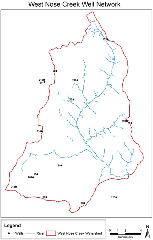
West Nose Creek
Click on the map below to download a PDF version.
|
Web PortalThe goal of this community-based monitoring project is to connect community members, researchers, and educators. In order for these groups to connect, there must be a location where communication and transfer of information can occur. This led to the development of the Rocky View Web Portal by Dr. Steve Laing and his associates in the Department of Geomatics Engineering at the University of Calgary. In December 2011, the web portal was first introduced to the participating landowners. After a brief testing period, the web portal went public in June 2012. This web portal, Rocky View Well Watch, has been designed specifically for Rocky View County using the GeoCENS technology and is divided into two sections – a private side and a public browser. To learn more about the basics - check out the Web Portal fact sheet.
The private side requires a log-in and allows landowners to input, view, and check their personal data. This resource provides feedback to participating well owners, which we hope will continue to motivate landowners to monitor their well. In addition, it is our hope that this technology will inspire additional landowners to join the well monitoring network. This site functions as a method to streamline data collection for all participants and make the information accessible to anyone interested in the local groundwater monitoring project. The public browser does not require a log-in and is accessible to anyone on the Internet. This public site allows people who are interested in groundwater resources in Rocky View County to access the data collected by well owners. The information collected by community members is used by researchers to better understand the local system and provide feedback to landowners and decision makers about their environment. Some of the interested members have included the provincial government, watershed partnership groups, and local school teachers. It is our hope that people will be able to use this long term monitoring data to better understand groundwater sustainability within Rocky View County. Watersheds in Rocky View County
There are a number of watersheds and sub-watersheds located within Rocky View County. The below map shows the boundaries of these watersheds. As part of the Water for Life strategy, one of the initiatives in Alberta is to have watershed partnership groups or advisory councils who work to protect water quality and quantity within their watershed.
Rocky View County includes the following watershed groups: Bow River Basin Council Published Report List Elbow River Watershed Partnership (Management Plan) Jumpingpound Creek Watershed Partnership - Management Plan Red Deer River Watershed Alliance Kneehills Subwatershed Report Little Red Deer River Subwatershed Report Rosebud Subwatershed Report Nose Creek Watershed Partnership (Management Plan) 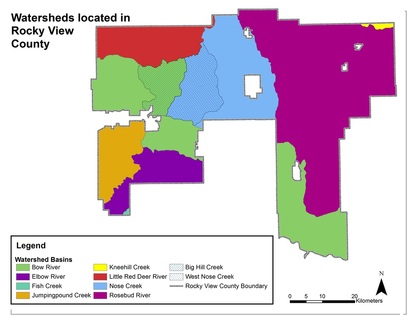
|
Videos - Well Measurements
|
This video illustrates the basic technique for taking a manual water level measurement with a water level tape. The measurement is taken without any problems encountered while obtaining the depth to water.
|
This video illustrates one technique that can be used when the water level tape encounters some type of blockage when being lowered into the well. You will see the field team raise the tape to get some slack and then re-lower the tape into the well. In addition the recommended 30 seconds between well readings is demonstrated.
|
|
This video is a manual measurement taken in a deeper well within the West Nose Creek network. The video illustrates the need to listen for the pump to ensure it is off in order to obtain a stable measurement.
|
This video illustrates one technique used to disinfect the water level tape after completing a manual measurement. In this video Krystal Chin uses a diluted bleach solution followed by distilled water.
|
|
This video was taken from an aircraft during 2006. It shows the location of some of the springs coming into West Nose Creek. This video also provides a snapshot of the topography of the landscape.
|
Thank you to our Project Partners
|

|

|

|
